Comment ça marche ?
Map
La carte interactive de vos projets

Plateforme cartographique SaaS

Communicante, ergonomique et intuitive

Administrable et personnalisable
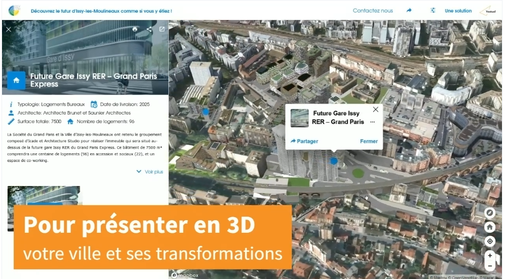
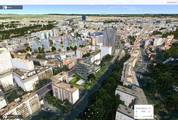
Votre ville et ses projets en 3D sur votre site Internet

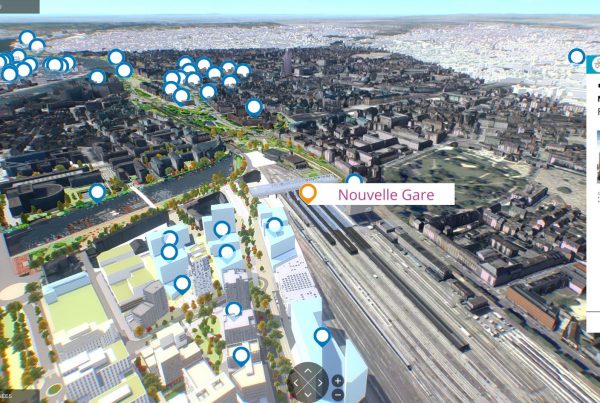
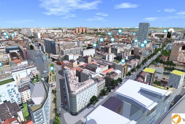
Vue Cartographique 3D et niveau street view

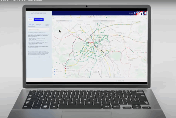
Plateforme de concertation et de communication citoyenne
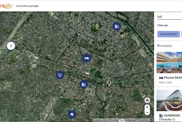
Les cartes Mappr
Inspiré des meilleures ergonomies web, Mappr vous donne la possibilité de représenter l’implantation de vos sites et projets sur un territoire 2D et 3D grâce une interface attractive et innovante.
Particulièrement adaptée au grand public et disposant de toute une gamme de fonctionnalités additionnelles, les cartes interactives créées avec Mappr sont 3D responsives, personnalisables et multilingues. Ses usages sont multiples : Communication, concertation publique, valorisation patrimoniale, aménagement du territoire, marketing territorial…
Les atouts de Mappr
Une carte interactive au service de votre communication
Une ergonomie communicante,
personnalisable et responsive
- Choisissez le fond de carte, la place des menus, les couleurs, les icones
- Mappr est pensé pour une utilisation multi supports– ordinateur, tablette, mobile- et multi langues.
- Des fiches personnalisables où les images et médias peuvent valoriser le contenu
- L’ensemble du contenu est éditable en toute autonomie grâce à notre Back Office.
Des fonctionnalités de recherches avancées
- Recherchez une adresse ou une information sur une fiche grâce à notre moteur d’indexation et de recherche.
- Une recherche géographique intéractive : la liste affiche uniquement les informations présentes sur la carte.
- Créez des catégories, des tags et des filtres personnalisés.
Une solution evolutive et immersive
- Visualisez vos projets en vue cartographique ou en vue piéton
- Partager facilement vos sélections
- Intégrez votre Mappr à votre site web
- Intégrez vos applications et pages web directement dans Mappr
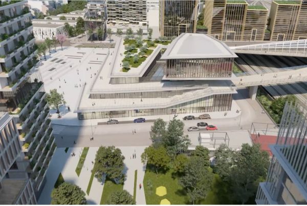
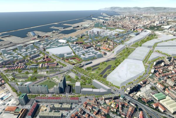
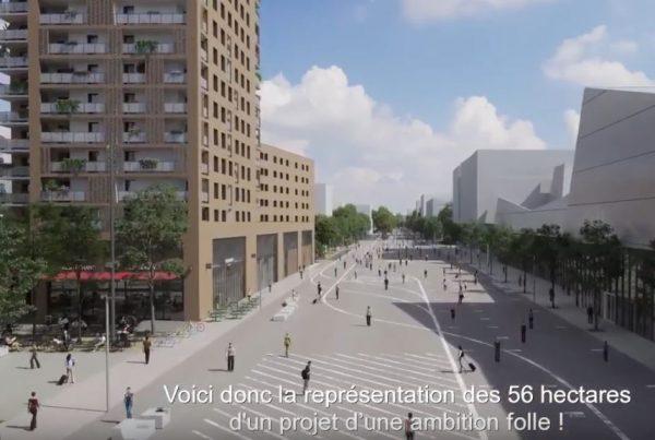
Votre territoire et ses projets en 3D
- Par défaut Mappr affiche tous les bâtiments en 3D blanche en se basant soit sur la base de données OpenStreetMap 3D soit sur la BDTopo de l’IGN
- Bénéficier des bibliothèques de villes en 3D de Vectuel ou Intégrer vos données 3D du territoire.
- Intégrer les modèles 3D de vos projets quel que soit leur format.
Test the Mappr experience of the Euroméditerranée project in Marseille
Ils ont créé leur carte Mappr
Toute l’actualité de Mappr
Ils nous ont fait confiance