Digital Twin & Data
La Défense in 3D HD: our 2025 oblique aerial imagery online and on mobile
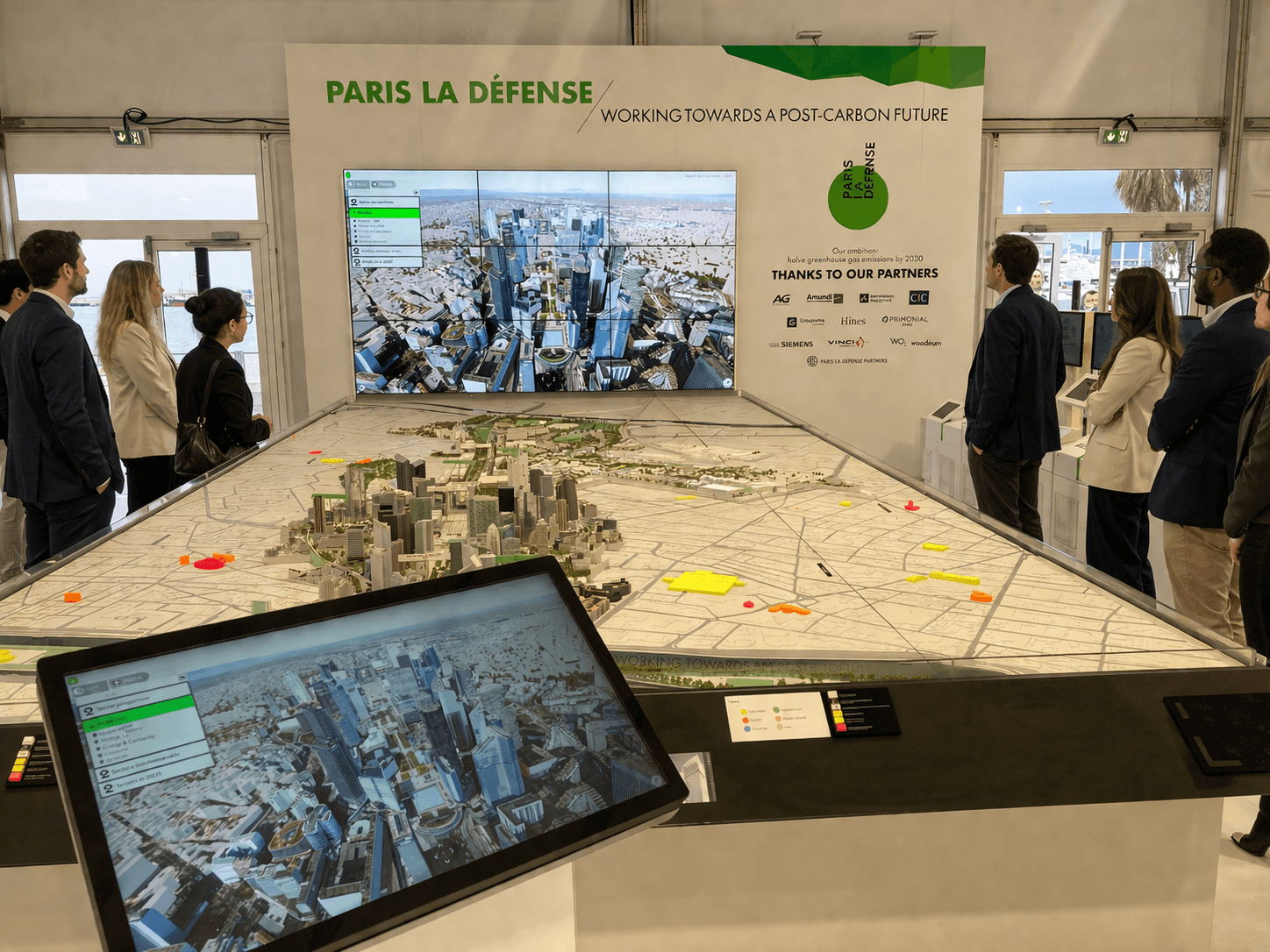
The Paris La Défense interactive project map is going high-definition 3D. Based on our 2025 oblique aerial imagery, it can be viewed on Urban Mappr®, both in your browser and on your smartphone.
·
3 min read

The interactive project map of Paris La Défense is switching to high-definition 3D. It is now powered by our 2025 oblique aerial survey (PVA): a photorealistic 3D mesh, an 8 cm orthophoto, and 3D-modeled vegetation. Hosted on Urban Mappr®, the map can be viewed in a standard web browser and runs smoothly on smartphones.
The future of Europe's leading business district now fits in your pocket.
What does the 2025 oblique aerial survey bring to the La Défense map?
An oblique aerial survey captures the territory from an angle, not just vertically. This captures building facades as well as rooftops, making it possible to reconstruct the city in 3D with its real-world textures. Our 2025 oblique acquisition campaign covered the entire Île-de-France region.
For La Défense, it produces three complementary layers:
A photorealistic 3D mesh: towers, the esplanade, railway lines, and public spaces are rendered just as they exist today.
An 8 cm orthophoto: each pixel covers 8 cm on the ground, sharp enough to distinguish street furniture and road markings.
3D vegetation: trees and planted areas are modeled, just as we did for the 19,850 trees in Issy-les-Moulineaux. The role of nature in the district becomes clearly visible.
On this true-to-life foundation, future projects appear in 3D volumes. At a single glance, you can see what is changing, on what scale, and where.
How to view La Défense in HD 3D on mobile?
Data with this level of accuracy is only valuable if it can be seen. Urban Mappr® delivers it directly over the web:
no software to install and no dedicated workstation needed;
a simple link is all it takes to open the map;
smooth navigation on computers, tablets, and smartphones.
An elected official can open it in a meeting, a project manager on a construction site, or a resident in the street. The future of La Défense, in high definition, can be viewed anywhere.
Data available across the entire Grand Paris area
The 2025 oblique aerial survey goes beyond La Défense. It covers the entire Grand Paris metropolitan area and is available off-the-shelf, with a level of quality never before achieved in the region.
The same data powers digital twin tools. It serves as a shared reference to analyze a site, integrate a project into its real context, prepare public consultations, or monitor a neighborhood's evolution.
Local authorities, urban planners, developers: there is no need to wait for a new survey campaign to obtain a faithful image of your territory. It already exists, ready to use.
Key takeaways
Territory: Paris La Défense, interactive project map.
Data: our 2025 oblique aerial survey.
Layers: photorealistic 3D mesh, 8 cm orthophoto, 3D vegetation.
Delivery: Urban Mappr®, online and on mobile.
Availability: off-the-shelf, across the entire Grand Paris area.
Your territory deserves to be seen in HD. Let's talk about your project.